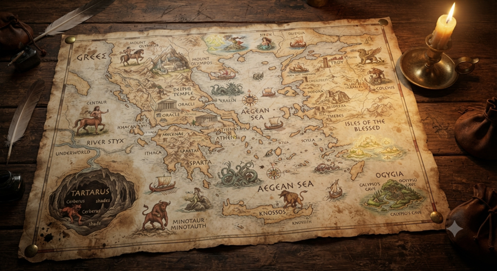
A map of mythical Greece was never a single fixed object in antiquity. It was a landscape of memory, cult, and poetry, shaped less by surveying instruments than by epic tradition, local worship, and the imagination of poets and travelers. In the Greek world as it appears in Homer, Hesiod, Apollodorus, and Pausanias, mountains could be divine thresholds, islands could drift into legend, and whole regions could be defined by the deeds of heroes rather than by political borders. A mythic map of Greece therefore looked familiar in outline, yet full of sacred places, underworld entrances, monster-haunted frontiers, and routes that connected gods to mortals.
Ancient Greece on Mythic Cartographers’ Maps
On the earliest imagined maps, Greece was not a neatly measured peninsula but a storied field of names. Homer and Hesiod present a world where places matter because of what happened there: Argos, Mycenae, Pylos, Ithaca, Sparta, and Thebes are not just settlements, but anchors for dynasties, wars, and divine interventions. A mythic cartographer would have drawn these sites with far more attention than empty stretches of countryside, because identity in Greek myth often flowed from city, lineage, and sanctuary.
Such a map would also have been uneven in scale. A small island might loom large if it was sacred to a god or tied to a famous hero, while a broad inland region might remain vague if no major story fixed it in memory. This is one reason Greek mythic geography feels both precise and hazy: individual places are vivid, but the spaces between them are often elastic, shaped by oral storytelling rather than administrative boundaries.
Olympus, Earth, and the Enclosing Ocean
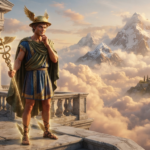
At the center of the mythic Greek cosmos stood Olympus, the mountain of the gods, though it was not simply a peak on a practical map. In Homer, Olympus is the bright home of the Olympian gods, elevated above the mortal world and imagined as a realm apart. Depending on the tradition, it can seem both geographically located in northern Greece and cosmically removed from ordinary human space. A mythic map would mark it as a summit of divine authority, not merely a mountain range.
Surrounding the inhabited world was Oceanus, the great river that encircled the earth in archaic Greek cosmology. This is especially clear in Homer and Hesiod, where Ocean is not an ocean in the modern sense but a boundary of the world itself. A map drawn from such traditions would not end at coastlines in the modern way; instead, it would suggest a living ring of water enclosing lands, islands, and the farthest edges of human reach.
Rivers, Mountains, and Sacred Landmarks
Greek myth assigned personality and power to rivers, mountains, and springs. Rivers such as the Alpheios, Acheloös, and Styx were not only geographic features but divine beings or sacred boundaries. The Styx, in particular, had a central role in oath-taking among gods, while the Alpheios appears in stories of Artemis and Arethusa in later tradition. Such waterways would have been drawn as more than lines; they were forces with agency.
Mountains, too, formed a sacred architecture. Mount Parnassus was linked to Apollo and the Muses, while Cithaeron and Helicon carried their own mythic associations. Springs and groves could be equally significant, since Greek religion often treated natural places as holy long before temples rose above them. A mythic map of Greece would therefore be crowded with symbolic terrain: not just settlements, but peaks, caves, and sacred waters where gods appeared, hidden, or were worshipped.
City-States, Sanctuaries, and Heroic Sites
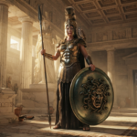
The Greek mythic map was deeply tied to the world of the polis, the city-state. Mycenae evoked the house of Atreus and the tragic cycle of Agamemnon; Thebes carried the stories of Cadmus, Oedipus, and the Seven Against Thebes; Athens claimed Athena, Theseus, and the contest for the land itself. These places were not interchangeable. Each city held a distinct heroic identity, and myth often explained why a city had its gods, rituals, and prestige.
Sanctuaries gave the map another layer of meaning. Delphi stood as Apollo’s great oracle, Olympia as the site of Zeus’s games, and Eleusis as the center of the mysteries of Demeter and Persephone. Hero shrines and tombs also mattered, because the dead could remain politically and religiously present. In Pausanias especially, Greece becomes a landscape of memorials, where altars, tombs, and temples preserve the deeds of long-vanished figures.
The Underworld Beneath the Mortal World
A mythical map of Greece did not stop at the surface of the earth. It extended downward to the underworld, a realm reached through caves, rivers, and liminal places. Greek sources do not place the underworld in one universally fixed geographic spot; rather, it lies beneath or beyond the mortal world, with entrances imagined at places such as Taenarum in Laconia or near dark caverns and chasms. These openings marked the border between life and death.
The underworld itself was mapped by rivers such as Acheron, Cocytus, Lethe, and Phlegethon, especially in later literary tradition. In Homer’s Odyssey, the dead inhabit a shadowy region in the west, and in later accounts, the geography becomes more elaborate. A mythic Greek map would therefore show not only the visible land of the living, but a hidden lower world of judges, shades, and river-bound passages that mirrored and inverted the human realm.
Islands of the Aegean in Legendary Geography
The islands of the Aegean held a special place in mythic geography because they often functioned as stepping-stones between mainland Greece, Asia Minor, and the wider divine world. Crete was associated with Zeus’s birth and the Labyrinth of Minos; Delos was sacred to Apollo and Artemis; Naxos appears in the story of Ariadne; and Rhodes, Lemnos, and Samothrace each carried their own divine or heroic traditions. On a mythical map, these islands were not peripheral at all. They were nodes of story.
Different sources sometimes emphasize different island identities. Crete may appear as the birthplace of a god in one tradition and as the home of a king or monster in another. Delos, once a floating island in mythic memory before being fixed in place, stands as a powerful example of how geography and wonder overlap. The sea between these islands was less a blank expanse than a traveled and narrated space, full of departures, shipwrecks, and divine signs.
Monsters and Boundaries at the World’s Edge
The edge of the mythic Greek world was often marked by danger. Beyond the civilized center, poets placed monstrous peoples, strange creatures, and lands of uncertainty. Homer’s world includes the Cyclopes and other distant beings, while later tradition adds more elaborate borders populated by giants, dragons, and hybrid creatures. These figures were not random ornaments; they defined where the Greek world ended and the unknown began.
Boundaries were especially important in mythic geography because they separated order from chaos. The Hesperides, the Gorgons, and the Hyperboreans belong to different traditions and are not always located the same way, but they all inhabit remote spaces at or beyond the edges of the familiar map. A mythical Greece looked inwardly ordered yet outwardly encircled by marvels, with the center of human life ringed by zones where the ordinary rules weakened or dissolved.
Delphi, Dodona, and Other Divine Oracles
Oracles were among the most important points on the mythic map because they connected geography to divine speech. Delphi, set on the slopes of Parnassus, was the most famous oracle of Apollo and often treated as the navel, or omphalos, of the world. Its position mattered as much symbolically as physically: it suggested a point where heaven, earth, and human inquiry met. Apollo’s sanctuaries across Greece gave the landscape a network of sacred communication.
Dodona in Epirus offered a different kind of sanctity, associated primarily with Zeus and older forms of divination. Unlike Delphi’s highly formalized prestige, Dodona often evokes an ancient, rustling sacred place of oak trees and whispered messages. Other prophetic sites, from Trophonius at Lebadeia to local shrines and hero cults, show that Greek mythic geography was not centralized. It was threaded with many voices, each rooted in a place and a tradition.
Homeric Routes Through a Mythic Greek World
Homer gives some of the clearest routes through this imagined landscape. The Iliad and Odyssey move between known ports, islands, and inland kingdoms while preserving the aura of an older, heroic age. Odysseus’s journey, in particular, transforms geography into narrative movement: each landing, detour, and encounter redefines the map. Ithaca is home, but it is also a point in a larger seaborne world of Aeolus, the Laestrygonians, Circe, and the edge of the dead.
The Iliad works differently, compressing the Greek world into the setting of Troy and the ships of the Achaeans, yet the wider map is constantly implied. Catalogues of ships, genealogies, and place names create a mental atlas of Greece, one in which every region has its leaders, memories, and alliances. Homeric geography is therefore both local and expansive: a network of routes, harbors, hills, and battlefields that gives myth its spatial backbone.
How Classical Sources Shaped the Imagined Map
Classical sources did not preserve one single map of mythical Greece; they preserved several overlapping versions. Homer gives one kind of heroic landscape, Hesiod another, Apollodorus a more organized mythographic summary, and Pausanias a traveler’s eye for cult, monument, and local story. These texts sometimes agree, but just as often they preserve regional variants, older traditions, and contradictions. That variety is part of the map itself.
Later readers, artists, and mapmakers inherited this layered geography and tried to make it coherent. The result was never a purely scientific cartography, because myth resisted simplification. The imagined map of Greece remained a living tapestry of sacred mountains, divine islands, oracle sites, underworld openings, and heroic cities. It looked less like a modern atlas and more like a world remembered through song, ritual, and story.
What did a map of mythical Greece look like? It was a sacred and storied landscape, where place names carried narrative weight and geography was inseparable from divine presence. Mountains could be thrones of gods, islands could be born from legend, and city walls could enclose entire cycles of heroism and loss. Rather than a neutral depiction of territory, it was a vision of the world ordered by myth, cult, and memory.
To look at such a map is to see how the Greeks imagined their own world: centered on familiar lands, yet open to the divine, the monstrous, and the dead. Its contours were drawn by poets, priests, and travelers, and its meanings changed from one source to another. That instability is part of its power, because mythical Greece was never just a place on paper. It was a living geography of stories.

Orin Vale has spent the better part of two decades tracing the threads that connect the world’s oldest stories — from the halls of Asgard to the banks of the Nile, from Olympus to the jungles of the Maya. What began as a childhood fascination with flood myths and trickster gods grew into years of independent study across comparative mythology and ancient religion, always chasing the same question: what did these stories mean to the people who first told them? Orin writes for readers who want more than trivia — the ones looking for the beliefs, fears, and truths that myths were built to carry.